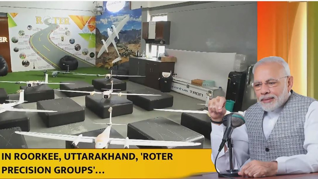
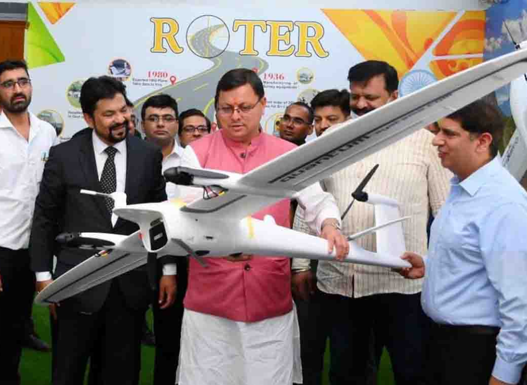
Roter Group of Companies humbly accepts the appreciation from our beloved Prime Minister Shri Narendra Modi
From receiving India's first commercial drone order of Survey of India to being recognized as India's best drone company by MoCA, we've consistently pushed the boundaries of innovation.
The recognition from Prime Minister on his Mann Ki Baat podcast (Episode 110) is a testament to our dedication. His words validated our vision: drones not just as tools, but as instruments for a better tomorrow.
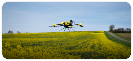
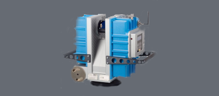
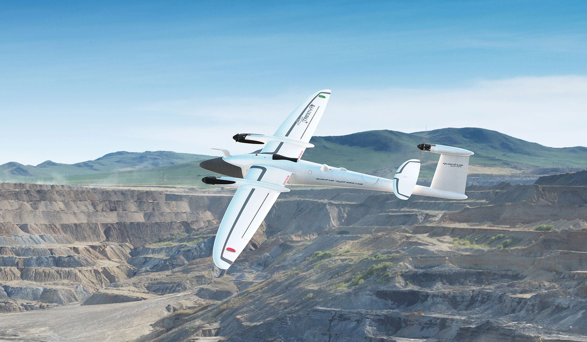
Our collaboration with the wildlife Institute of India with the iconic Trinity F90+, helps preserve the national wildlife. Trinity F90+ is the only mapping drone certified for various payload configurations (𝐋𝐚𝐫𝐠𝐞 𝐒𝐜𝐚𝐥𝐞 𝐌𝐚𝐩𝐩𝐢𝐧𝐠 𝐒𝐞𝐧𝐬𝐨𝐫, 𝐇𝐢-𝐑𝐞𝐬 𝐒𝐞𝐧𝐬𝐨𝐫, 𝐋𝐢𝐃𝐀𝐑 𝐒𝐞𝐧𝐬𝐨𝐫, 𝐎𝐛𝐥𝐢𝐪𝐮𝐞 𝐒𝐞𝐧𝐬𝐨𝐫 𝐚𝐧𝐝 𝐌𝐮𝐥𝐭𝐢𝐬𝐩𝐞𝐜𝐭𝐫𝐚𝐥 𝐒𝐞𝐧𝐬𝐨𝐫) With the recent 𝗧𝘆𝗽𝗲 𝗖𝗲𝗿𝘁𝗶𝗳𝗶𝗰𝗮𝘁𝗶𝗼𝗻 from DGCA, we look forward to join in our nation's development under the esteemed leadership of our honorable Prime Minister..
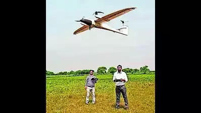
TRINITY F90+ TAKES FLIGHT AND PIONEERS AERIAL SURVEYS ACROSS INDIAN SKIES
Trinity F90+ received the esteemed DGCA certification following a rigorous two-year evaluation in 2023. Proudly crafted under the Make in India initiative at our Roorkee facility, the Trinity F90+ stands out as the singular Mapping Drone accredited with diverse mapping payloads:
-
Standard Camera for Large Scale Mapping
-
Hi-Res Camera for Precision Mapping
-
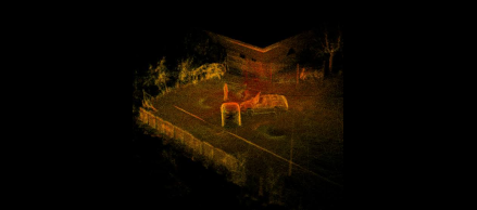
LiDAR Sensor for Engineering Mapping
-
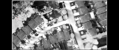
Oblique Camera for High Accuracy 3D Urban Mapping
-
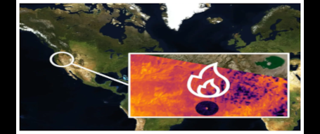
Multispectral Camera for Scientific & Agricultural Mapping
With a large fleet soaring in diverse projects, notably SVAMITVA, discover how it's sculpting the future of precise, reliable, and expansive aerial surveys.
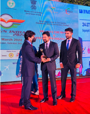
ELEVATING INNOVATIONS AT ROTER, ACCLAIMED AS INDIA'S TOP DRONE MAESTRO BY WINGS INDIA 2022 AND MOCA
Celebrate with Roter as we ascend to new heights, crowned India's best drone company by prestigious entities - Wings India 2022 and Ministry of Civil Aviation. Join us on our journey of pioneering aerial innovations, where we merge passion with technology to enable you to accomplish more in less time.
Patent Grant
Exciting News: We’ve been granted a patent for our revolutionary Flexible Configuration Multi-Copter Drive System! This innovative technology allows seamless switching between quadcopters, hexacopters, and octocopters, boosting performance and versatility. Key benefits include:
- Adaptability: Switch configurations effortlessly
- Enhanced Performance: Adjustable motor controls and rotor speeds
- Cost-Efficiency: Modular design cuts costs
- Customizable: Tailor to specific needs
This patent represents a major leap in UAV technology,driven by our commitement to innovation and excellence.
Stay tuned for more updates!
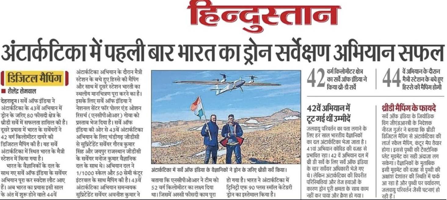
Trinity F90+ mapped Antartica
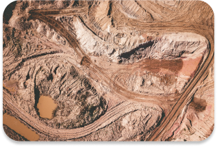
In an impressive display of precision and reliability, the DGCA Type Certified Trinity F90+ has successfully completed a comprehensive 42 sqkm survey, covering 80% of the area in 3D mapping under the supervision of Survey of India officials.
This milestone was achieved in 43rd mission by Trinity F90+ after other drones crashed in 42nd mission, showcasing its enduring performance and versatility in challenging conditions.
Roter not only supplied the advanced Trinity F90+ UAV but also customized it with better aerodynamics, battery heating case, designed to endure extreme weather conditions, ensuring uninterrupted operation.
The SOI team commended Roter's exceptional support, highlighting the company’s expertise in assisting pilots to navigate challenging wind conditions.
Celebrating Success with Trinity F90+
The Workhorse Behind Swamitva Yojana's 88 Lakh Property Cards!
Uttar Pradesh’s Swamitva Yojana has reached a major milestone with 88 lakh property cards, thanks to Roter’s Trinity F90+ UAV.
The Trinity F90+ has excelled in aerial surveying with over 90 minutes of flight time and centimeter-level accuracy using advanced PPK technology.
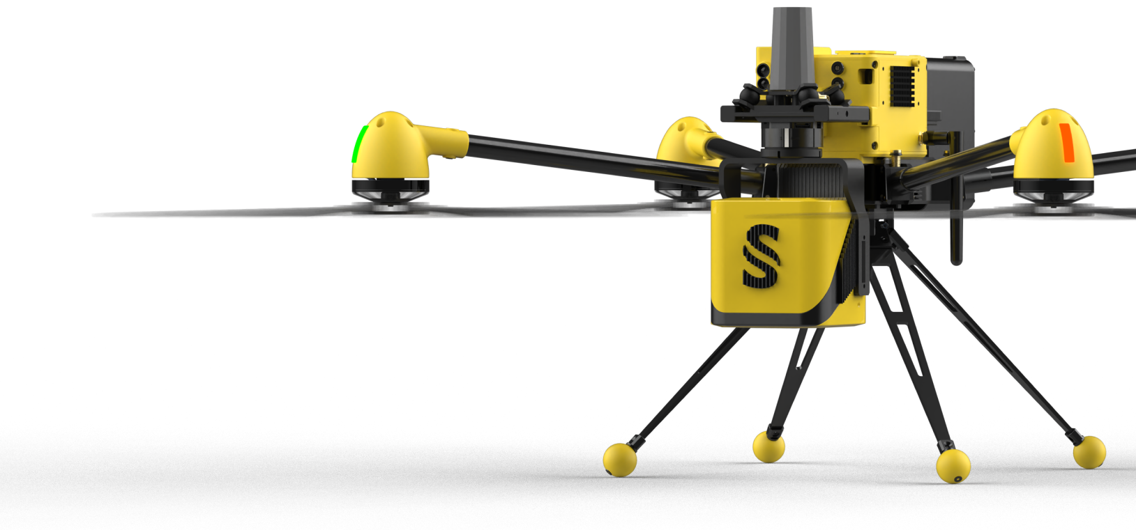
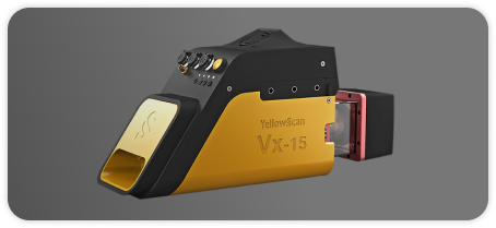
It’s India’s only UAV Type certified by DGCA for high-resolution RGB, Multispectral, Oblique cameras and LiDAR payloads.
The Survey of India’s involvement underscores the initiative’s commitment to transparency and efficiency.